
backpacking high | mono pass
3000 ft gain . 12800 ft peak . 9 miles
Let’s just start out by saying Mono Pass was one of my most favorite backpacking trips and one of the most varied terrain – and all within 10-12k ft elevation. And why might this be such an awesome trip? Well, read on!
This trip was filled with highs and lows. My friends and I weren’t going to any tourist-y locations, we just wanted to be in the wilderness and leave our computers at work for just one weekend. With our work schedules, we figured we could afford a 3-day, 2-night trip, so we set off to the eastern Sierras on Thursday night after a long day’s worth of work. Surprisingly, the drive from LA to Lone Pine did not take too long. And before we knew it, we were pulling up at our cute historic hotel.
1st road block: logistics. Permits are a hassle in California. Not gonna lie, it was a long, impatient wait before we could talk to a ranger and more time before getting a permit. Ranger stations typically open at 8am and people often start lining up outside at least 15-30 minutes before. We took a gamble on more sleep and arrived right when the Lone Pine office opened. But boy was it the wrong gamble! It took over 30 minutes before our number was called. At least we were entertained by wandering the museum and store – one of my favorite things at visitor centers is the 3D map of the mountains.


At the front desk, we started talking with the ranger. Knowing that permits are scarce, we had chosen 3 top areas, including Bishop Pass, Kearsarge Pass, and the Whitney Portal. Or literally anything that wasn’t a long drive north but still got us above the tree line.
Sadly, none of our ideal options were open. Apparently hikers had taken most permits by Thursday morning and the few people in line before us took the rest. We were left with the option of either going north past Bishop or south towards Cottonwood, which seemed mosquito-infested at lower elevations. And we learned that you can’t cheat the system because the Sierra permits are per trailhead and direction. And they definitely check your permits on the trail – we learned that real quick.

Upon much debate, we decided on Mono Pass up north. Hip, hip, hooray! We finally could get going on our adventure. As we drove north on Hwy 395, we unnoticeably gained a lot of elevation. By the time we got to the trailhead, we had traveled from an elevation of 3,700 ft at Lone Pine to 10,300 ft at the parking lot. Even here, you could feel the low oxygen levels, and I was a bit worried if I’d get altitude sickness like I’ve had before.
Before merrily hiking along, there were a few house-keeping things we had to do. Unlike the Cascades, the Sierras are high bear country and even food in the car needs to be locked in the bear-proof storage lockers at the trailhead. Since we brought extra food, we took cherry-picked what we really wanted for the hike and hoped it all fit in our 1 bear barrel and stored the rest away.
Now onwards to the wilderness part of our adventure. The first mile or so starts out pretty level, following the luscious valley, passing the rushing river and greeted by wildflowers along the way. I was honestly surprised to see mostly the same alpine flowers as I do in the Cascades. However, there were some variations within plant species. For example, some of the paintbrush are more pink in California though, rather than the fiery red-orange common in Washington.
As the trail to the pass broke off from the main valley trail, we started climbing uphill. We all felt the elevation hit us in different waves with different effects. Personally, I thought the views were so fulfilling I could push past feeling less than 100% while hiking. Little lakes would pop up here and there. Meandering rivers emerged from the trees and meadows. And as the clouds rolled in, the perfect uniform light made the valley even more gorgeous.


But then little clouds turned into fluffy clouds. And fluffy clouds turned into a rainy mist. And after we exited our dry hiding from under the trees, the rainy mist decided to turn into a tiny hailstorm. No big deal right? Thankfully we all had started to put on rain jackets and our backpacks were decently water resistant. With proper gear, bad weather becomes more tolerable.
Taking a turn around Mt. Starr towards Mono Pass, we continued in the wet weather and bade goodbye to the green valley below. Ahead of us was the barren land above the tree line. No trees, no shrubs, no life but the Summit Lake and all the rock and sand surrounding it. Near and over the pass, we encountered mild snow – since we didn’t know where our permits would have taken us, we actually brought traction devices, but ended up not needing it for this quick stretch of soft, yet firm snow.


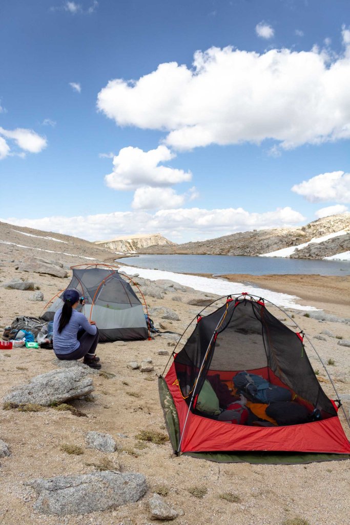
At the pass, we could finally see our home for the night, Summit Lake. Rest at last! We found a small, flat area and set up camp while letting our wet clothes dry off. It was still early, so we took a short break inside out tents. Good thing we decided to put the rain fly on cause the temporary sky break was indeed temporary. It started pouring again as we got everything under the covers.
After waiting out the storm again, we started making dinner, enjoying the peace and rest at 12000 ft. Sun sets fairly late in the summer, so we ended up going to bed just as the sunlight went over the edge of the neighboring mountain. It wasn’t particularly colorful, since the grey clouds had not cleared up entirely. Overnight, we did get bright stars and constellations, though our tent was still wet from condensation and dew in the morning. It didn’t help that one of the poles was broken and not supporting the rain fly correctly. So once we were awake, we decided to fix the part with the emergency splint, which worked magically and lifted the rain cover off of the tent.


Before everyone else woke up, I went on a morning hike to catch the sunrise. It’s amazing where the sun will take you. When I first got out of the tent, I thought I would only go to the end of the lake and watch from there, but the further I explored, the further up I went, finding another valley as luscious as the one we walked through before. The golden glow of the sunrise on the mountains to the north kept becoming more spectacular and the valley started to fill with light. I hardly wanted to leave, but we had a wake up call. I walked back to camp to wake up my friends before starting breakfast.


We enjoyed a lazy morning, filled ourselves up with oatmeal and topped up our bottles with fresh alpine water. Now we were ready for a full day of adventure. Originally, we wanted to scramble to Mt. Mills. I’d say that we were comfortable with most scrambling, but still beginners and fairly cautious. With little knowledge of this climb, we slowly made our way up from Mono Pass. It started off mild, hardly a scramble, but steep scree navigation. Then the further up we went, the more boulders we encountered. I’d scout the route and my friends would follow, or vice versa. In the end, we had misestimated this “unmaintained trail” clearly marked on the ranger station’s map, which in reality, was a non-existent scramble route. Possible to scramble, but not defined at all.
Spending some time scouting left and scouting right, we determined that it was impassable from the height we were at. No good way to easily get down to another saddle and climb what looked more like 4th class climbing to get to Mt. Mills – the summit of which we honestly had not seen at all. We could make out the famed Bear Creek Spire and other peaks, but Mills was most likely hiding behind the scramble in front of us. We’d already been out for 3 hours, so it was a good turnaround time anyway.


But all was not at loss. All the while up, we were graced with beautiful views as we passed between the rocks. One valley here, one valley there. And we had made it to 12,800 ft, a first for 2 of us. And bagged a peak – Mono Pass Peak. I can’t complain!
Resuming our goal of a chill adventure, we took a nice long lunch break under the warm summer sun. Meandering down the scree slopes (more like running), we made it back to camp and took a short nap. Tear down was fairly quick and we made it up and over Mono Pass again, back to the fertile lands. But before picking out our next campsite, we headed to Ruby Lake for a quick detour. From the pass, it looked beautiful but up close, it was spectacular. Alpine lakes are always such a beauty with their crystal clear, yet emerald green waters. No matter how many times I see one, my jaw always drops.


Movement is key when you walk into a home of mosquitos that chase you. Truth be told, I had over 50 bites by the end of this. I made it a point to keep moving even when we were “stopping” and quickly put on layers and my rain jacket as armory against these pesky insects. Our second campsite was closer to the trailhead, but still at a higher elevation with a sweet, sweet view of Bear Creek Spire. I knew that we’d get the perfect sunrise.


And indeed, when we woke up bright and early (to catch a flight later that day), the mountains were shining golden. The early hike out was short and breezy with plenty of wildflowers to keep me entertained. The trailhead came too soon, and we were back in civilization with toilets and all. Even at the trailhead we were still at 10,000 ft. The wilderness continued to surround us on our drive out. Although I wanted to spend more time in the high sierras, this short trip still left me refreshed and recharged. The perfect getaway.
Photos shot on Canon Rebel T6
You May Also Like

aquamarine | lago di sorapis

multisport fun | rainier attempt via ingraham direct
